|
Getting your Trinity Audio player ready...
|
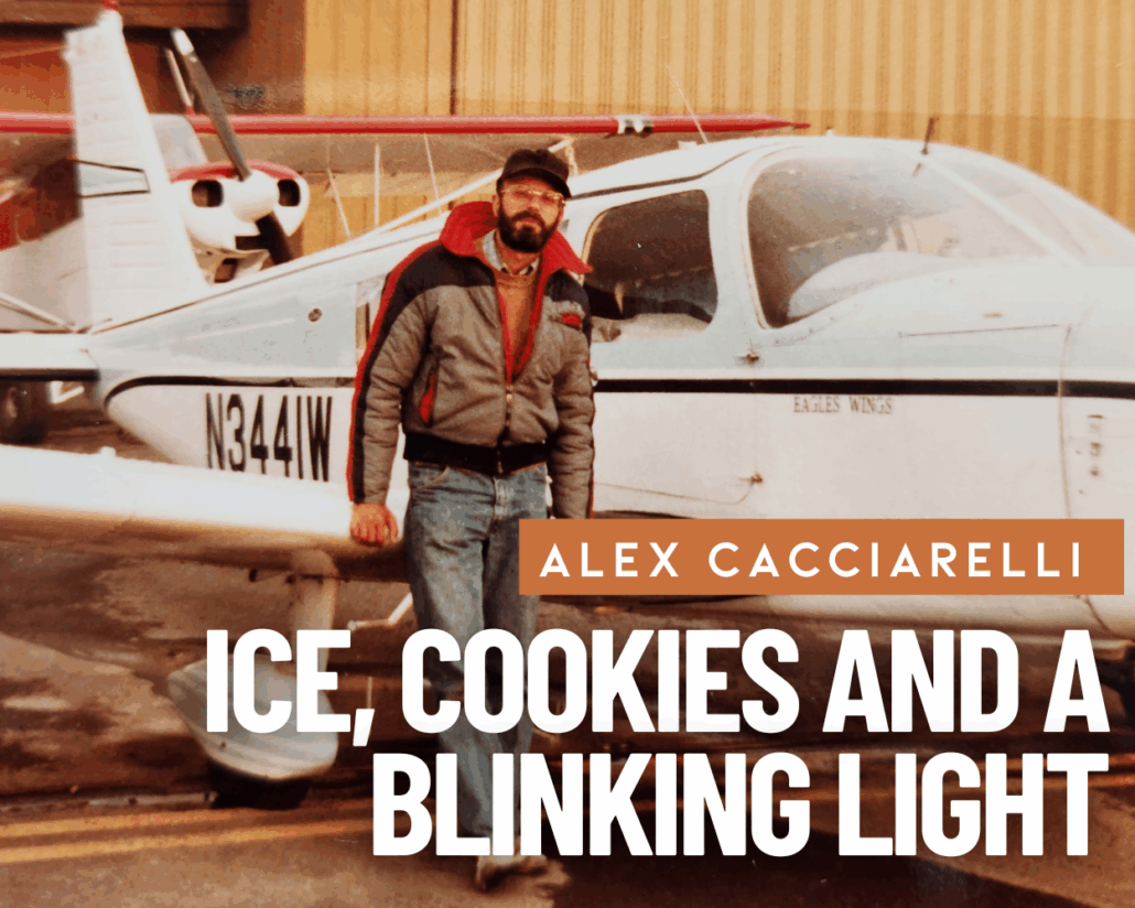
A Short Story from the Adventures of Yukon Bob and Tundra Al
Having flown small, light aircraft for over 25 years, I have numerous adventures recorded in my aviation logbook. One especially stands out as I take a nostalgic look back through my old, worn entries.
The logbook entries from 26 July to 14 August 1983 center around a flight from Pontiac, Michigan, to Eagle River, Alaska, in a Piper Cherokee 6 single-engine aircraft—a journey of roughly 4,000 miles, mainly through the western provinces of Canada.
This amazing trip was organized by my brother, Robert, and me. Our plan was to visit our mother’s cousin, Peggy Rusnak, who lived in a small A-frame house in Eagle River, north of Anchorage. This short story focuses on a portion of that trip and explains what ice, cookies, and a blinking light have in common.
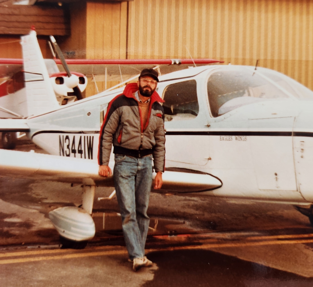
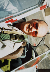
The author with the Cherokee Six
A Bit of Background
Navigation for small aircraft in those days relied on a few methods. There were no digital computers or GPS systems, and radar coverage—especially in Canada and Alaska—was sparse. Pilots navigated primarily by following things on the ground (pilotage) or by plotting a course on a map and compensating for wind drift and magnetic variation. This method was called dead reckoning—a lousy term. If your calculations were correct, you reached your destination. Sometimes, you didn’t.
A more “sophisticated” method, especially for instrument weather conditions, was following Low Frequency (LF) or Very High Frequency (VHF) radio waves. But these were subject to interference from atmospherics (storms and the Northern Lights) and terrain (mountains).
The Flight
Flying across central Canada—through Manitoba, Saskatchewan, and Alberta—was relatively easy, as these provinces are fairly flat. But in British Columbia and the Yukon, the Rocky Mountains turn rugged and desolate. The Canadian government required us to carry extensive survival equipment: a rifle, water, food, clothing, and an emergency locator transmitter (ELT). At customs, identification and survival gear were the focus—they weren’t particularly interested in anything else.
Although some weather forced us onto instrument flight plans at times, we navigated our way up the Alaskan Highway to Whitehorse in the Yukon. This is where my story begins.
To safely cross mountains into Alaska, we had to fly above 10,000 feet, requiring supplemental oxygen. (Alaska has 29 mountains exceeding 14,000 feet.) Even on an instrument flight plan, radar coverage was spotty. We relied on our maps, old dead reckoning, and radio waves when possible.
Departing Whitehorse, our destination was a small airport in Northway, Alaska. Immediately, we were in clouds with no visual reference.
After an hour, ice began forming on the windows and wings—never a good sign. Small at first, it quickly became a concern. Our aircraft had no anti-icing equipment, and climbing above the clouds wasn’t an option. Descending was the only choice—but when? More ice would force the decision. Our map showed mountains with tops at 8–9,000 feet.
By a remote transmitter in the mountains, I was able to speak with a Canadian air traffic controller, explaining our ice situation. He couldn’t clear us to descend without a precise position report. Robert, monitoring our time aloft, said, “Unless we’re hitting a strong headwind, we must be past those high mountains on the map.” We gave the controller our calculated position, and he cleared us to descend. Slowly, we dropped below the clouds, saw the ground, and realized we had cleared the mountains. We landed at Northway, happy to be on solid ground. “Whew!!”
The Northway airport was basic, with a log-cabin office and small restaurant. After fueling, we sat down to eat. Observing the patrons, we realized many were native Alaskans.
Feeling nervous about the rest of the trip, we watched a helicopter land outside. A teenager emerged and entered the restaurant. He worked for a company that patrolled oil pipelines. Our luck in meeting him couldn’t have been better.
I explained our ice situation and our plan to fly to Eagle River. He asked, “Where are your maps?”
I pulled out our sectional maps. He studied them and said, “Look, you are here. This airport is along a portion of the Alaskan Highway. When you take off, follow the road west until you see a blinking light, then turn left and follow the road south. That road will take you all the way to Eagle River. If you have trouble, just land on the road—there isn’t much traffic. Watch the scenery, but don’t fly into a mountain, and stay out of the clouds.”
“A blinking light? You’ve got to be kidding!” I said.
“Nope,” he replied. “If you can’t see the light, you shouldn’t be flying.”
We thanked him. I nervously went to preflight the aircraft. Meanwhile, Robert walked down from the restaurant carrying a paper sack.
“What’s in the sack?” I asked.
“Cookies!!”
“COOKIES?? COOKIES!! We’re going to have a difficult flight, and you’re eating cookies??”
Robert calmly said, “Alex, if we’re going to kill ourselves, I’m not going to be hungry.” That was my brother. Immediately, he eased my nervousness, and we both laughed as we finished preflighting the plane.
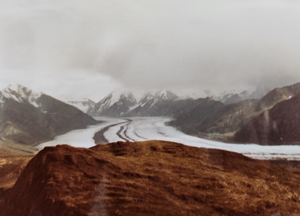
Taking off, we followed the road, scanning for the blinking light. About twenty minutes later, out of the gloom, a big blinking light appeared on a hill near Tok, Alaska. We turned left, picked up the road going south, and flew around 800 feet over the terrain. As the helicopter pilot had said, the scenery was awe-inspiring: glaciers, pine forests, lakes, and snow-capped mountains. Robert took pictures—and ate cookies.
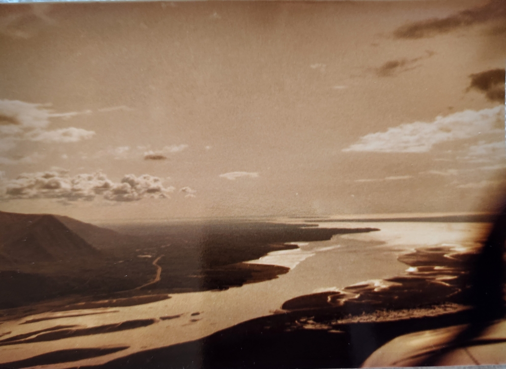
We flew south for 1.5 hours past Gulkana, then another 1.5 hours to Birchwood Airport in Eagle River. Near the end, weather was marginal at Chickaloon Pass, with some rain showers, but visibility allowed us to get through. Emerging from the pass, we saw the airport bathed in bright sunlight. While making an 180-degree turn to set up for our final approach, we glimpsed a majestic mountain west of us—later confirmed as Mount McKinley (Denali), over 200 miles away.
Landing at Birchwood Airport in Eagle River
We had reached our destination. The rest of the Alaskan tour and visiting Peggy calls for another story.
But we will always remember the young man’s advice on flying Alaska, which once again served us well as we “followed the roads” back to the flat lands of Canada on our return flight home.
Postscript:
With special thanks to my sister, Ms. Elaine R. Cacciarelli, for her professional advice and editing.
In the past he held a commercial pilot’s license rated for single engine land, glider and instrument.
His interest in aviation goes way back to the 1940’s when he was inspired by his cousin Bobby Zander who flew a B-24 during WW2.
In 1971, when Alexander was called upon to do military service, he naturally chose the USAF because of Bobby and his interest in aviation.
Alexander resides in Goodyear, Arizona near Luke AFB where he watches an airshow every weekday outside of his kitchen window.
- Ice, Cookies and a Blinking Light - November 26, 2025


So, you flew IFR, or as I have heard it called, “I Follow Roads!” :-)
Great story! Just one nit: It’s *ded* reckoning for *deductive* not dead, for what you don’t want to do!
I got lost for a short time flying a Cessna 172 through Windy Pass on the way from Fairbanks to Anchorage after picking the wrong road to follow. A glance at the compass showed that I was headed east on the south side of the Alaska Range rather than south. I climbed to 14,600′ MSL (no oxygen) until I could receive Anchorage VOR and was saved…